GARDEN ROUTE | KAROO NEWS - The South African Weather Service has advised that hot to very hot and uncomfortable conditions are expected over the Kamiesberg Local Municipality in the Northern Cape, as well as over the West Coast District in the Western Cape until Thursday, but only on Thursday over the Cape Winelands, Little Karoo, as well as western parts of Central Karoo district.
Impact-based warnings
A. Yellow level 2 warning: Severe thunderstorms leading to localised damages to infrastructure, property, vehicles, and injuries (livelihood and livestock) due to hail, damaging winds, heavy downpours and excessive lightning, are expected over the Eastern North-West, Gauteng, Western Mpumalanga and South-Western regions of Limpopo.
B: Yellow level 1 warning: Severe thunderstorms leading to localised damages to infrastructure, property, vehicles, and injuries (livelihood and livestock) due to hail, damaging winds, heavy downpours and excessive lightning, are expected over the north-eastern regions of KwaZulu-Natal.
Fire danger warnings
Extremely high fire danger conditions are expected over the north-central parts of the Northern Cape.
Regional weather forecast
Western Cape:
Partly cloudy with isolated showers and rain over the extreme south-eastern parts in the morning, otherwise fine and hot to very hot but cool to warm in places over the southern parts. Wind along the coast will be fresh to strong southerly to south-easterly, becoming fresh easterly to north-easterly along the south-coast in the evening.
The expected UVB sunburn index: extreme
Western half of the Eastern Cape:
Cloudy in the morning, otherwise fine and cool. Wind along the coast will be light to moderate southerly to south-westerly.
Eastern half of the Eastern Cape:
Partly cloudy and cool with a 30% chance of light rain south of the escarpment, but cloudy along the wild coast. Wind along the coast will be moderate southerly to south-westerly.
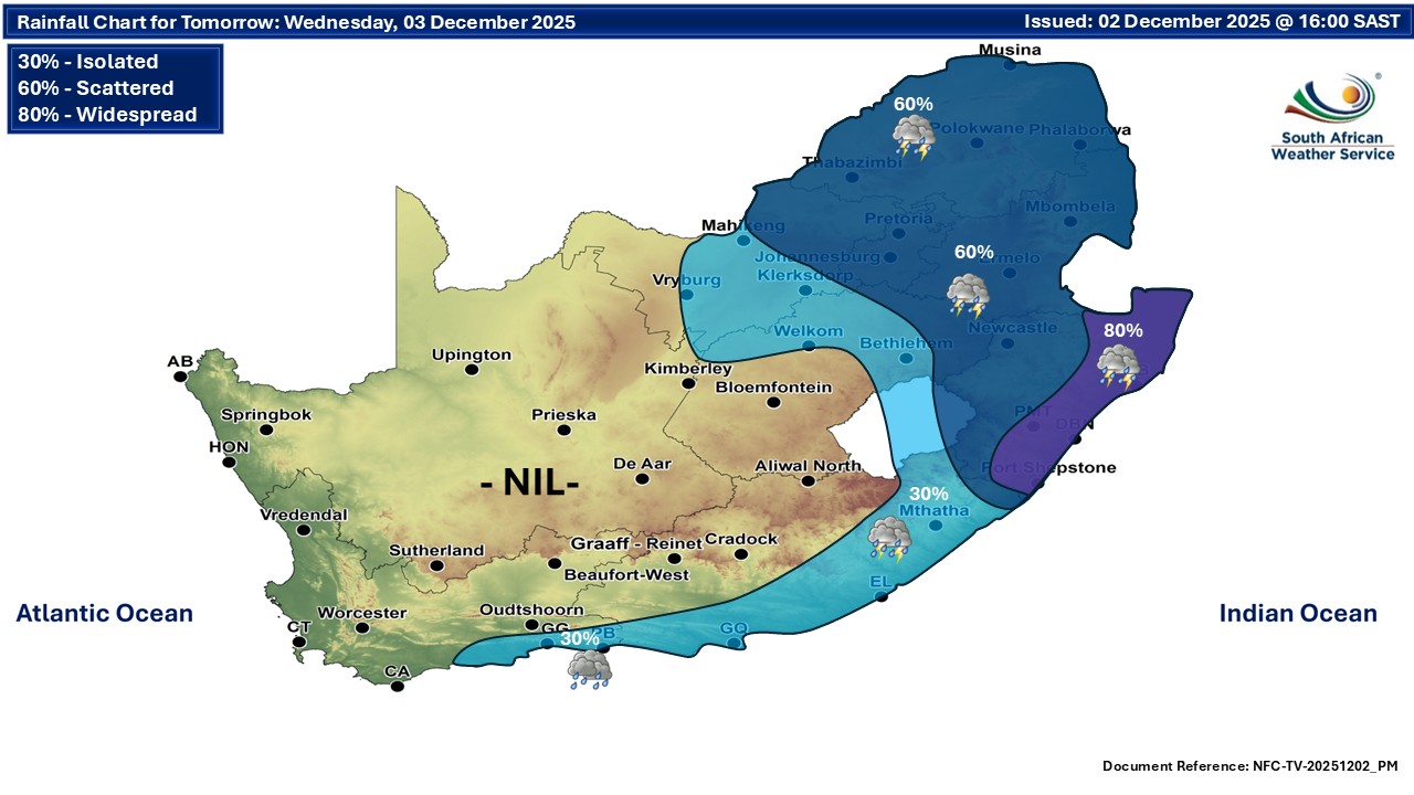
Expected temperatures on Wednesday

‘We bring you the latest Garden Route, Hessequa, Karoo news’