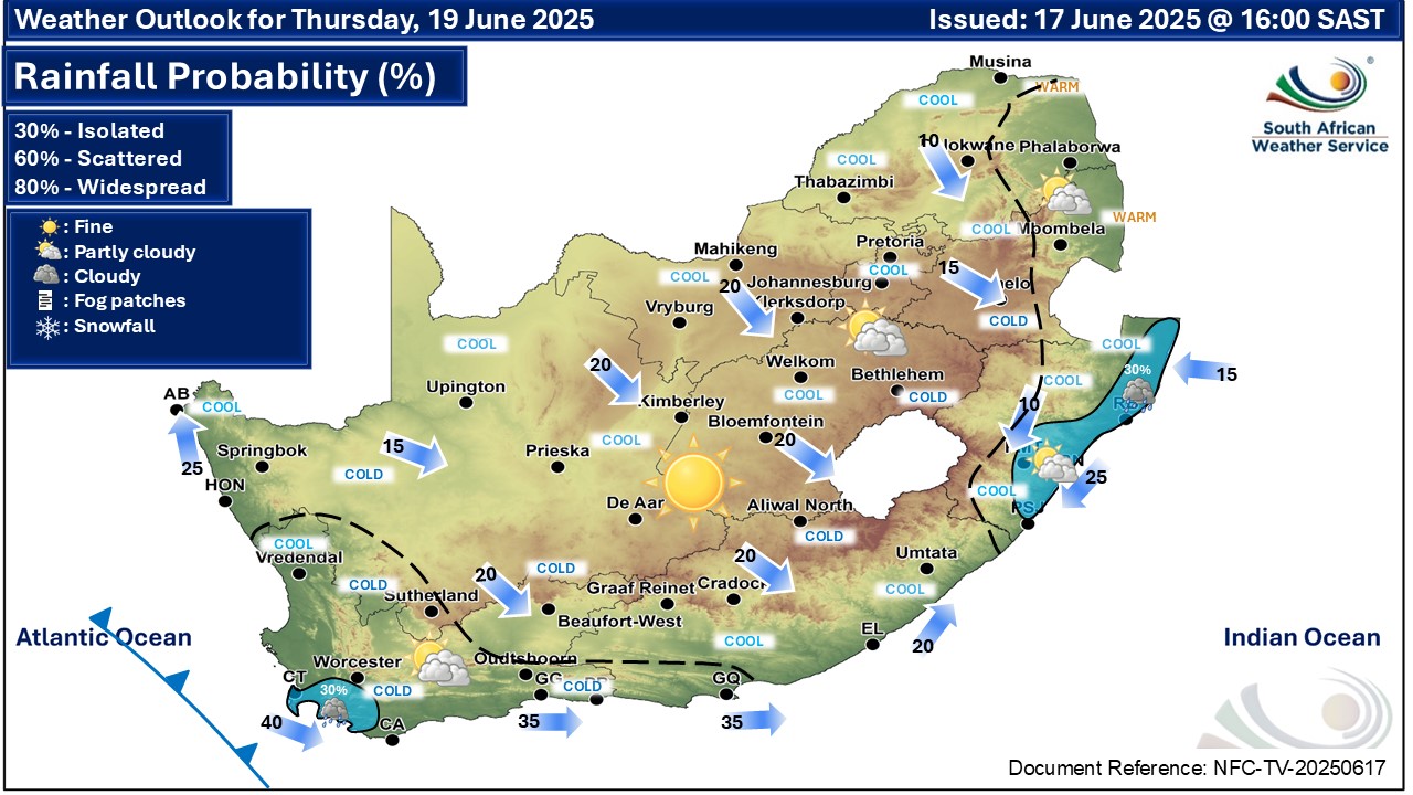
GARDEN ROUTE | KAROO NEWS - In the latest weather forecast from the South African Weather Service, very cold conditions with daytime temperatures of 10° C and below, are expected in places over the interior of the Western Cape from today, Wednesday 18 June, through to Saturday.
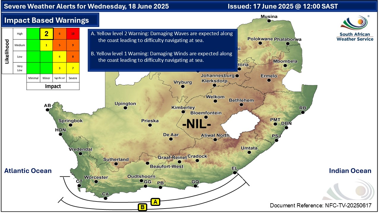
Impact-based warnings
A. Yellow level 2 warning: damaging waves resulting in difficulty in navigation of small vessels, small vessels taking on water and localised disruption to beachfront activities, are expected between Saldanha Bay and East London.
B. Yellow level 1 warning: damaging winds resulting in small vessels having difficulty in navigation, taking on water and dragging anchor, are expected between Cape Point and East London.
Western Cape:
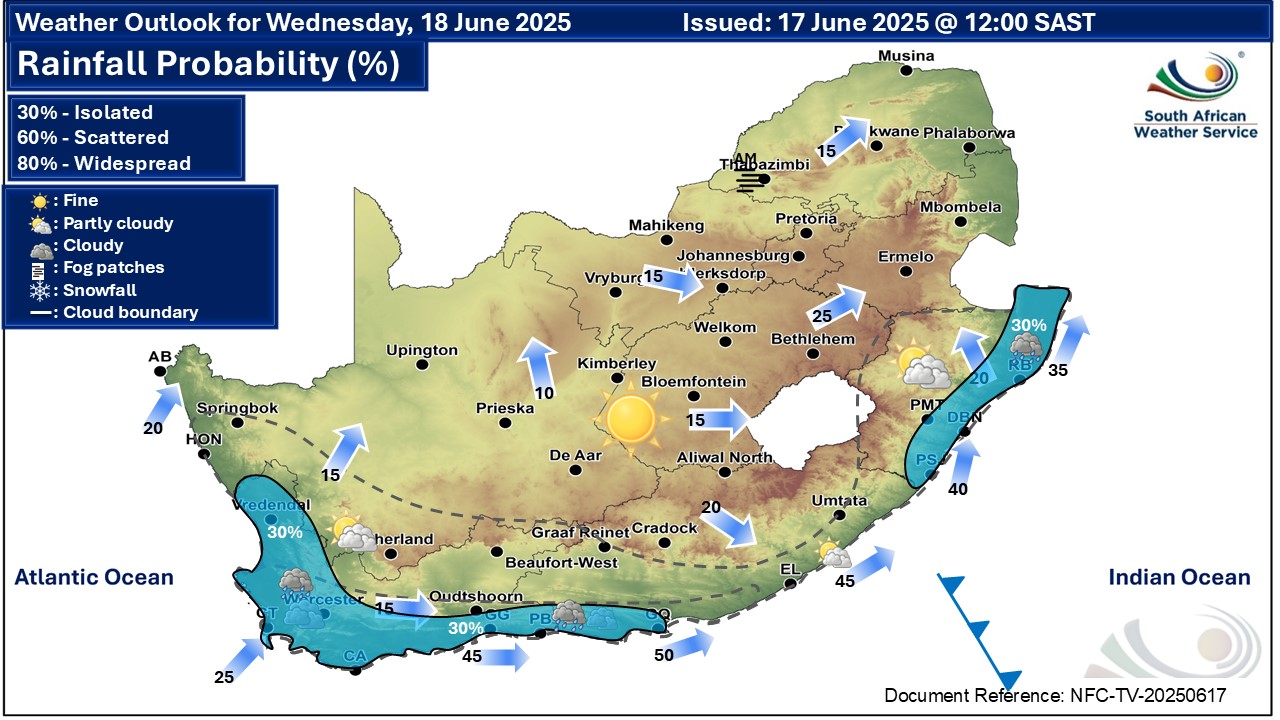
Western Cape residents can expect cloudy and cool to cold weather with isolated showers and rain, except in the northeast, where it will be partly cloudy.
Eastern Cape (western half):
The day will be cloudy in places along the coast with isolated showers and rain west of Port Elizabeth; otherwise, it will be partly cloudy and cold but fine in the northeast, where morning frost is expected.
Eastern Cape (eastern half):
The day will be fine and cold with morning frost in places in the north. It will be partly cloudy along the coast.
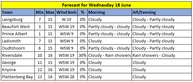
Expected temperatures on Wednesday:
‘We bring you the latest Garden Route, Hessequa, Karoo news’