GARDEN ROUTE | KAROO NEWS - The South African Weather Service (SAWS) has warned that the Western and Eastern Cape will experience disruptive rain from Sunday into Monday, 28 October. Various alerts have been issued for our region:
"Yellow Level 2 warning for disruptive rain leading to localised flooding of susceptible settlements or roads, low lying areas and bridges is expected over the southern Namakwa (N.Cape), northern parts of the West Coast, western parts of the Central Karoo as well as over most parts of the Garden Route district on Sunday into Monday (27 October -28 October).
"Yellow Level 2 warning for damaging winds leading to difficult driving conditions and localised damage to settlements is expected over the City of Cape Town, Cape Winelands, Overberg, Garden Route and Central Karoo municipalities (W.Cape) as well as over the Karoo Hoogland municipality (N.Cape) on Sunday (28 October).
"Yellow Level 3 warning for damaging wind and waves leading to danger to navigation and disruptions to ports and small harbours is expected between Lambert's Bay and Plettenberg Bay on Sunday into Monday (27 October -28 October).
Here is your extended forecast:
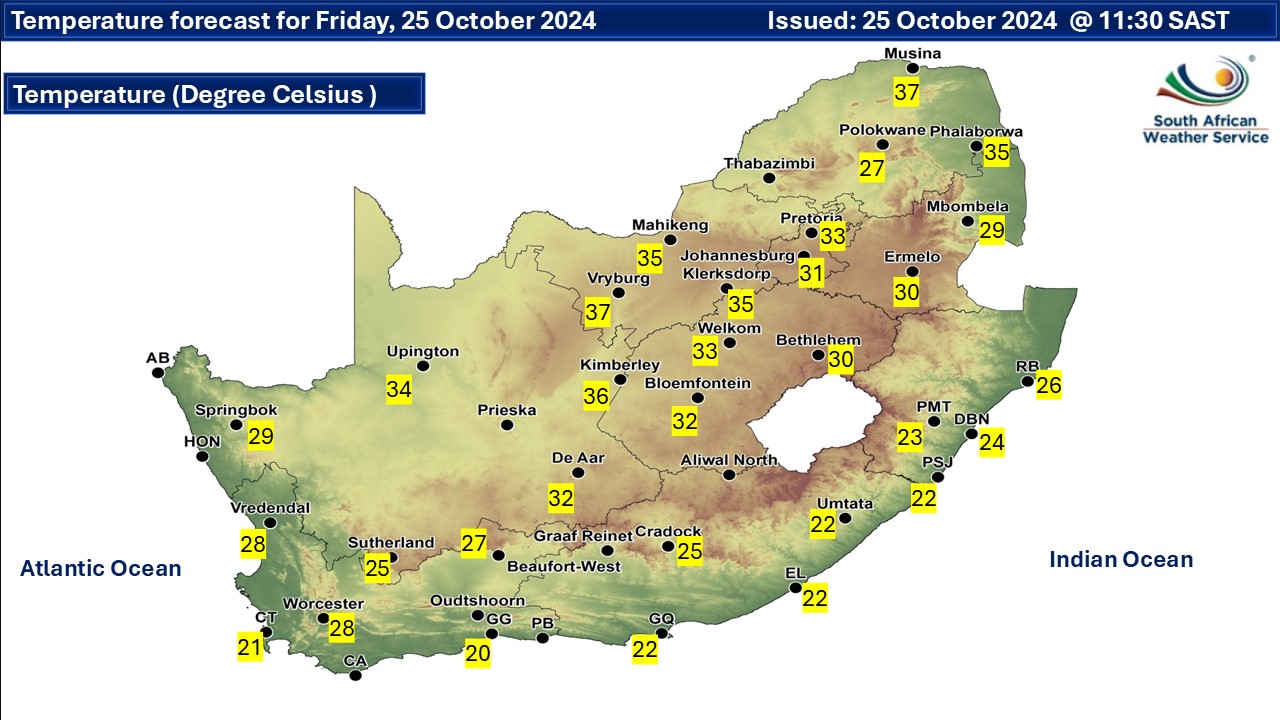
Friday will be warm to hot temperatures across the country but very hot in places in the north.
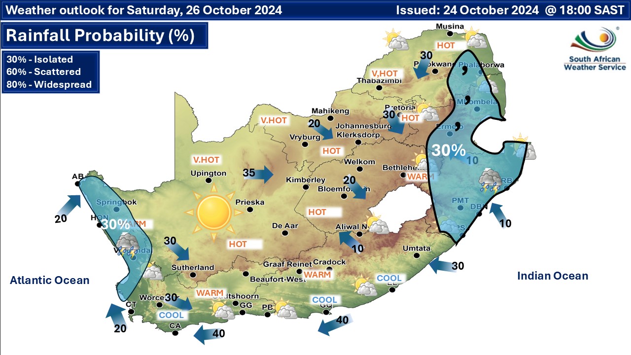
According to SAWS, "No significant weather is expected on Saturday, but isolated showers and thundershowers in the east and west coast. Temps are expected to be warm to hot but very hot in places."
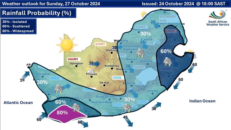
On Facebook SAWS says, "Extended weather forecast for Sunday, 27 October - A cut-off low weather system is expected to make landfall over the SW parts of South Africa, resulting in isolated (30%) to scattered (60%) showers and thundershowers but widespread (80%) in most parts of the Western Cape Province. Warnings will be issued in due cause."

‘We bring you the latest Garden Route, Hessequa, Karoo news’