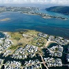
GARDEN ROUTE NEWS - Almost out of the blue, this past Monday the Garden Route was hit by a period of persistent rain. In only a few hours some parts of Knysna and Plettenberg Bay had more than 20mm of rain.
The rain was very welcome, as the CX region has endured a slightly drier summer season than usual.
November 2022 yielded only 24,5mm of rain in Knysna, a strong departure from the average of 85mm that is expected during the month. Rainfall improved somewhat in December and January, but the best was yet to come.
For the majority of last week it rained steadily though mostly lightly. The weekend was rather warm, creating the expectation that the rain was over. But the weatherman had other ideas. After starting out like any other day, Monday saw a drastic weather change.
By midday, storm clouds came rolling in over the Garden Route, including Sedgefield, Knysna and Plettenberg Bay. The rains bucketed down and, combined with a storm surge, blocked drains and high tide made for a devilish cocktail that led to flooding in some parts of Knysna.
Storm drains in the centre of Knysna were overflowing into the roads and flooding various parts of town, including Gordon Street.
Waterfront Drive was flooded too, opposite the Caltex garage on the western side of town, as well as opposite Food Lover's Market and along several other points of the road.
In itself the rain was in all likelihood not enough to cause flooding, but coupled with the blocked drains and storm surge, it made for a very wet Monday in Knysna.
The South African Weather Service had predicted the storm surge on Monday morning, issuing a Yellow Level 1 Storm Surge warning.
According to the warning they were expecting wave heights of between four an five metres, and wave periods of between 12 and 14 seconds, in addition to gale force winds.
The biggest causes of concern were going to be at high tide on Monday at 15:00 and on Tuesday morning at 03:00.

'We bring you the latest Garden Route news'


