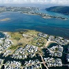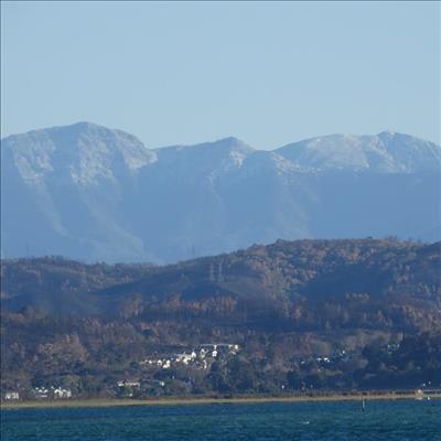
GARDEN ROUTE NEWS - Residents from Sedgefield to Plettenberg Bay woke up on Sunday with the mountains surrounding them capped with snow.
From late Saturday evening, July 15 through almost the entire Sunday, July 16 residents were forced to remain indoors or put on layer upon layer of clothing to battle the winter chill.
According to a forecaster for Weather SA, Wayne Venter, this is weather typical of winter in the Southern Cape, and although the heavy rains the region needs so much might not be here yet, he said we can expect more of the same for the coming weeks.
“What we had this past weekend was a well-developed cold front at the surface, with a decent upper air system. This caused a significant cooling trend across the southern and central parts of the country, and was, in fact, more of a snow event than a rain event, even though decent rainfall figures were recorded throughout the Western Cape,” said Venter.
The snowfall experienced by the region, he said, was due to “freezing levels” (0°C line) dropping down to about 1 000m above sea level. “This created the significant snowfalls on the mountains and even snow on lower elevations like the mountains close to the coast (Outeniqua, Tsistikamma), and was the first proper snowfall event for the Western Cape this year,” added Venter.
But will this snowfall have the possibility of turning around or alleviating the water crisis that especially Knysna is experiencing at the moment?
According to Venter it won’t help much. “The snow to water ratio is very low which means that snow will melt but won’t really help the dam levels. It will, however, increase soil moisture and this will help in future months with growing of vegetation.”
And what about the rain that fell almost all through Saturday evening until Sunday?
Venter said that the 10 to 20mm recorded rain in some areas across the Eden District, and the 25mm recorded in Plettenberg Bay specifically, would help dam levels a little. “Looking at this week, rainfall amounts will be much less and any decent fronts will move south of the country.”
Venter added that there was a possibility of some light rain and showers during this week, especially on Thursday, July 20 and Saturday, due to onshore flow behind weak frontal systems.
“These will result in cooler temperatures but unfortunately this will not really help the dam levels. We need a consistent, large system which will produce good rainfall for a few consecutive days to help dam levels, but unfortunately this doesn’t seem to be in our forecast in the next week-and-a-half,” said Venter.
According to Venter, residents can expect temperatures to hover around the high teens and low twenties in the Knysna area this week, “so it will remain cool, which is typical for winter”.
ARTICLE: STEFAN GOOSEN, KNYSNA-PLETT HERALD JOURNALIST
'We bring you the latest Knysna, Garden Route news'