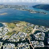
KNYSNA NEWS - The N2 by-pass road on the hill tops north of Knysna town has been on the cards for many years. Recent planning studies around sea-level rise and the predicted physical effects on Knysna town has revealed the need to urgently revisit the construction of a by-pass road.
"The existing N2 alongside the estuary may just be unusable in the foreseeable future if it were washed away by a storm surge, with massive repercussions for those who travel daily to Sedgefield and George," says Mr Low Kannemayor from the National Road Agency (NRA).
KPH has obtained a copy of a report that is in an advanced stage behind closed doors of NRA. Key extracts from this report are provided for our readers in promotion of transparent decision making. "Knysna needs to get back on a high road," says the local business council.
Effects of sea level rise
Recent newspaper reports have shown the impact of increasingly high tides in Knysna.
 In early 2010 the Western Cape Government released a report on the effects of sea level rise in the Garden Route area. The map below is taken from this report.
In early 2010 the Western Cape Government released a report on the effects of sea level rise in the Garden Route area. A conclusion from this early report was as follows:
Later study
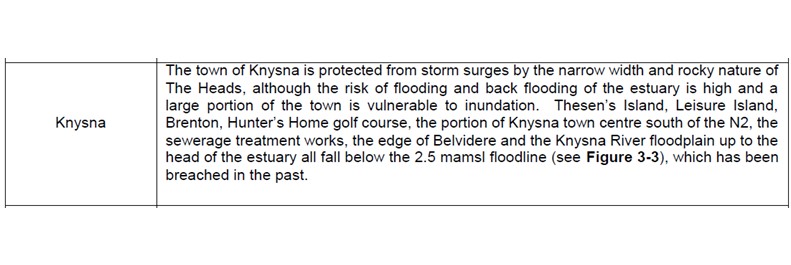
In March 2019 an updated reviewed report titled, ‘Garden Route District Climate Change Adaptation Strategy’, was released by DEA&DP, plus the Garden Route District Municipality. This report concluded that, ‘sea level rise and associated hazards are a major concern for coastal areas within the District. Sea level rise impacts are likely to include inter alia coastal erosion, flooding, destruction of infrastructure and salt water contamination of fresh water bodies (Western Cape Government, 2013). Within the Garden Route District Municipal Area, 54 square kilometres in Knysna Local Municipality are estimated to be below a 5.5 m elevation (Department of Environmental Affairs 2013b). These areas under a 5.5 m elevation are at risk of being negatively affected by the predicted increases in storm surges, sea level rise and tidal fluctuations, due to climate change.
"We have to understand what the net effect of climate change will be as we have to be able to plan around it if we want to maintain the levels of lifestyle that we have become used to."
(Cobus Meiring, GREF, July 2023)
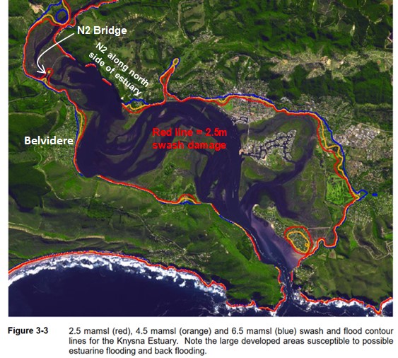
The existing road hazards and by-pass road options - new ideas - The previous map shows the existing N2 road along the Knysna Estuary coincides with possible erosion areas. Pipes – water and sewage, cables, pump stations and speed traps all exist along this road. "If the road or these services was damaged it would have devastating consequences for Knysna," said the Temporary, Acting, Stand-in, Substitute, Replacement Technical Director #. When contacted by KPH, Kannemayor of the NRA was reluctant to reveal too much and said that a PAIA must be made if fool details are required of the new by-pass road. Tenders will go out shortly.
OPTIONS: Previously two options for the Knysna By-Pass were looked at, both north of the town. The initially preferred option (red line below) was a re-routed N2 to the hill tops north of Knysna – see map below.
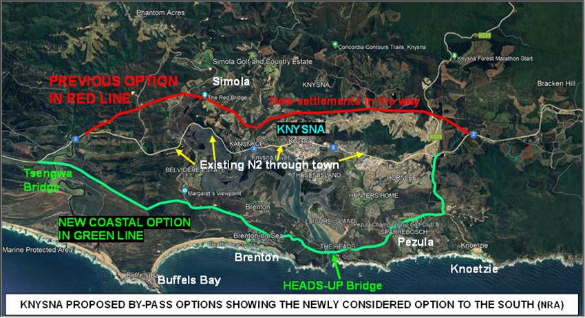
"However, unbridled expansion of informal and formal settlements along these hill tops now makes it virtually impossible to build a National Road here," said Chief Roads Engineer, Mr McAdam, of Sanral.
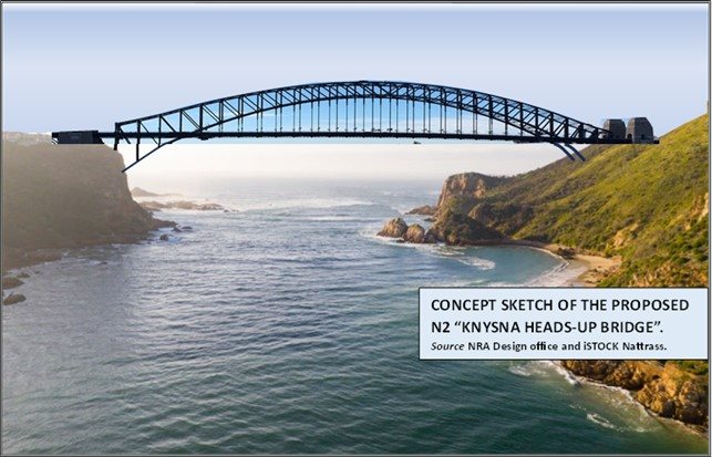
The EIA would take years and Knysna does not have the time. Consequently, a southerly option has been looked at and received favour from tourism, the current Knysna Municipal officials, and Cadre Bridge Construction CC. The idea is to re-route the N2 southwards of Hornlee with upgrade to the Noetzie road, and then along the coastal hills passing Pezula to the Knysna Heads. A cantilever arch bridge, similar to the Sydney Bridge, would be constructed over The Heads. "This would provide a magnificent view inland of Knysna town and estuary, thereby attracting shoppers and foreign tourists to Discover Knysna," said the Tourism CEO, Travel Faraway.
The road would then follow the existing Brenton hills main road, which will be easy to upgrade, cutting down to the Buffels Bay plain and crossing the Goukamma river with the new Tsengwa Bridge to link to the N2 at Mielierug.
The Knysna Mayor says he prefers this option as he is trying to build bridges in the community.
When will the public have their say? Any residents or organisations wishing to register as Interested and Affected Parties (I&APs) can fill in their details here.
HAPPY APRIL FOOL'S DAY!
True author of this April Fool's Day article: Ritchie Morris
‘We bring you the latest Garden Route, Hessequa, Karoo news’